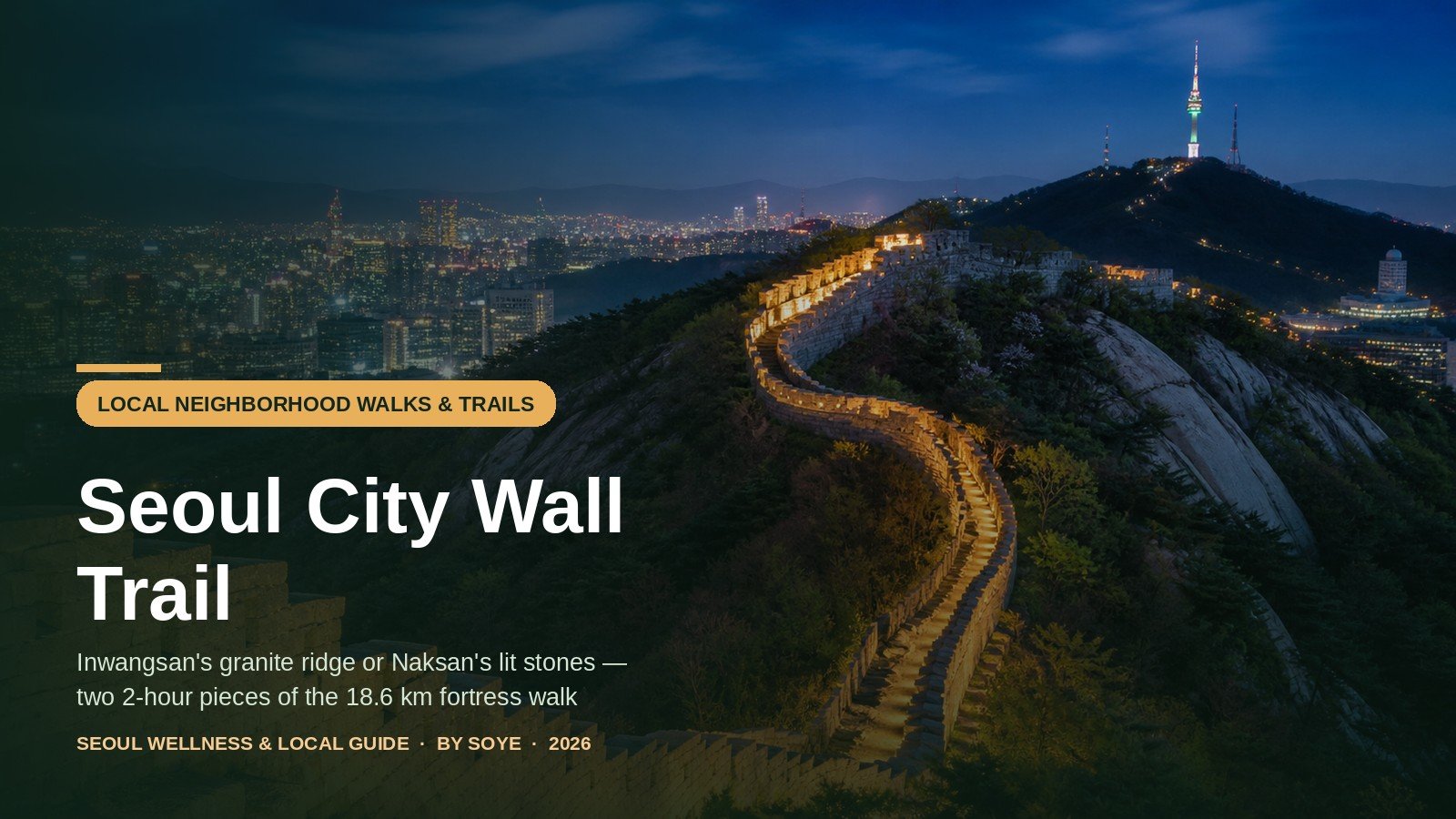
Eighteen point six kilometres of stone around four mountains, six centuries old, free at any hour. The Seoul City Wall is the best half-day hike in the city, and most English guides get the practical part wrong: which sections to walk, where the subway puts you out, and the one spot where you must put the camera away.
What follows is the practical version: the two sections worth your daylight, the exact exits, the security rules that still apply, and the honest answer on the badge — the “four stamps, one metal badge” story online merges two programmes and lists the wrong gates. Figures were checked on 18 November 2026 against the city wall authority’s pages and the Korea Heritage Agency’s rules.
Photo rules and the 2026 openings: On the Baegak (Bugaksan) trail photography is allowed only at designated points — the Baegangmaru summit stone, the marked viewpoints and Cheongundae — and Inwangsan’s summit and ridge carry Capital Defence Command signs, posted in October 2025, forbidding photographs toward the military installations and banning drones. Identity checks ended in April 2019, 24-hour access was confirmed in March 2026, and a new 1.32 km southwestern path opened on 17 October 2026.
Quick Verdict
Walk Inwangsan for the granite ridge and the sunset over Gyeongbokgung; walk Naksan after dark for the lit wall and the descent into Hyehwa. Both are free, need no booking and take about two hours. Leave the 18.6 km circuit for a day with ten hours in it.
The 18.6 km loop, and the two pieces worth your afternoon
The wall was raised in 1396, in the fifth year of King Taejo. The court drafted 197,400 people for 98 days and cut the line into 97 sections named in the order of the Thousand Character Classic, each assigned to a province — which is why stones carry the name of the county that laid them. Five to eight metres high and 18.6 km long, it was the boundary of Seoul for 514 years until 1910; about 70% of it, 13.7 km, survives or has been rebuilt.
The authority divides that line into four trails: Baegak 4.7 km and three hours, Naksan 3.2 km and one hour, Namsan 6.7 km and three hours, Inwangsan 4.0 km and two and a half hours. That is 18.6 km and about nine and a half hours of moving time, eleven or twelve with stops — and in mid-November the sun leaves at 17:19, so a single-day circuit finishes in the dark. People do it. They mostly do it in two or three visits.
Two sections give the most for two hours, and they are opposites.
Inwangsan is the mountain. The wall climbs a ridge of bare granite above Sajikdan and the Blue House, past a curved bastion and a rock ledge called Beombawi, to a 338 m summit with a full circle of city beneath it. The climb is real, the surface is rock, and the reward is the view every Seoul postcard imitates — a gentler cousin of Bukhansan’s Baegundae granite, with a city instead of a wilderness below.
Naksan is the story. A 124 m hill on the east side, walked from Heunginjimun up through a hillside village to a park, then down past a mural village into Daehak-ro. Almost no climbing, restored and lit wall, doable in trainers after dinner. Choose it if you have one evening, or if you are with someone who does not hike.
All four are open 24 hours, free, and need no ticket, reservation or ID; passport checks and Monday closures belong to a system that ended in 2019 and 2023. Two exceptions: on Baegak, photographs only at designated places and no lighting at all; on Inwangsan, one bastion is still an active military site.
Whenever I take someone up Inwangsan for the sunset, I put the camera away on the last stretch to the summit. The signs are new, the unit behind them is active, and a phone pointed north across the wall is the one mistake in this city that ends with an officer rather than a comment.
The other thing I plan around is the light. Mid-November sunset is 17:19, so the granite ridge is beautiful for about twenty minutes before that and genuinely dark twenty minutes after — which is why I start up at 15:30 with a headlamp in the bag, and save the Naksan wall for after dark, where the path is lit and the descent drops you into Hyehwa for dinner.
The four sections side by side
Distances and times are the authority’s own; “best window” assumes you want the light rather than the fewest people.
| Section | Distance | Climb | Best time | Subway in / out | Highlight |
|---|---|---|---|---|---|
| Inwangsan 인왕산 |
4.0 km 2 h 30 |
338 m · ★★★★★ Rock slabs, steep stairs |
15:30–18:00 sunset |
In: Gyeongbokgung Ex 1 Out: Changuimun, bus 7212/1020/7022 |
Beombawi ledge; summit panorama |
| Naksan 낙산 |
3.2 km 1 h (2.1 km of wall) |
124 m · ★★ Paved, stepped |
Dusk–21:00 wall lit |
In: Dongdaemun Ex 10 Out: Hyehwa Ex 2 |
Naksan Park decks; Ihwa stairs |
| Baegak 백악 |
4.7 km 3 h |
342 m · ★★★★★ Stone stairs throughout |
09:00–15:00 winter; unlit |
In: Gyeongbokgung Ex 3 + bus Out: Hansung Univ Ex 5 |
Baegangmaru; 1·21 pine; Sukjeongmun |
| Namsan 남산 |
6.7 km 3 h |
270 m · ★★★ Park paths |
Sunset–late tower lit to 23:00 |
In: Dongguk Univ Ex 5 Out: Hoehyeon Ex 4 |
Beacon mound; Jamdubong |
Runners use the same ridge differently: the Namsan north ring route skips the tourist traffic.
Course A: the Inwangsan ridge and its sunset
The official route is 4.0 km from the Donuimun gate site to Changuimun in about two and a half hours. This version starts lower at Sajikdan, cutting the streets and reaching stone sooner.
- Start at Gyeongbokgung Station, Exit 1. Sajikdan, the Joseon altar to the gods of earth and grain, is five minutes up the road. Use the toilet and buy water here: after this point there is nothing, and the city’s own guidance says so. The Sajik Daeje is held on the third Sunday of September; the rest of the year it is a quiet lawn under the wall.
- Follow the wall signs uphill past Sajik Park. You join the official line at the Inwangsan sunseong shelter: steep in short bursts, shaded for twenty minutes. The authority’s exact start is Donuimun, five minutes from Seodaemun Station Exit 4.
- Look, and keep walking, at Inwangsan Gokseong. The bastion watches the western approach and is still a military installation: civilians cannot enter, and a signed detour takes you around. Take it without argument, and without pointing a lens into it.
- Stop at Beombawi. A flat granite shoulder with central Seoul below — Gyeongbokgung, the Blue House roofs, Namsan Tower, the towers of Jongno. This is the shot, and where the wind arrives: put a layer on before you settle.
- Tag the summit and descend the other side. The 338 m top is bare rock with a 360-degree view and, in winter, ice in the shaded steps. The wall then drops to Yun Dong-ju Hill and his small literary museum, then to Changuimun, the only small gate that kept its Joseon gatehouse. Buses 7212, 1020 and 7022 run from Jahamun Gogae back to Gyeongbokgung Station, or walk twenty minutes down into Buam-dong for dinner.
The sunset problem. The ridge faces the city, so the sun sets behind you and the light lands on Gyeongbokgung, the Blue House and Namsan. Sunset on 18 November is 17:19. To be at Beombawi for the colour and off the granite before full dark, leave Gyeongbokgung Station by 15:00: two hours up, twenty minutes for the view, an hour of twilight down. If you are late, turn around at Beombawi.
Recent changes. A spring 2023 wildfire burned the Seodaemun side; the district finished its first restoration phase in January 2026, rebuilding about 200 m of the steepest eroded rock as stone steps with handrails. The route is in better shape than old reports suggest.
Sajikdan also leaves you ten minutes from the hanok alleys of Seochon, the best way to end the day if light remains: our Seochon versus Bukchon guide has the curfews, teahouses and detours.
Course B: the Naksan night walk
Naksan is the wall at its most sociable. The hill is 124 m, the path is paved or stepped throughout, and the wall between Hyehwamun and Heunginjimun is 2.1 km — an hour at a stroll. The authority lists the trail as 3.2 km because it counts the street connectors.
- Come out of Dongdaemun Station at Exit 10. The Seonggwak Park stretch of wall is two minutes away; Exit 1 puts you in front of Heunginjimun. Before climbing, find the grey building on the lawn by Exit 7 — the Heunginjimun office and one of the four stamp points.
- Walk north with the wall on your right. Ogansumun water gate site, then Dongdaemun History & Culture Park, where the Iganmun water gate sits in the lawn. The wall is low and half-sunken here; climbing starts after the park.
- Climb through Jangsu Village to Naksan Park. The lane narrows between 1960s houses, and this is a lived-in neighbourhood: keep voices down, especially at night. Near the top the Ammun, the “secret gate”, connects village to park.
- Take the summit decks. From 124 m you get Dongdaemun Design Plaza, Namsan Tower and the whole Baegak ridge at once. Toilets sit at the central plaza and the summit, with a small shop — the only section with either.
- Descend past Ihwa Mural Village to Hyehwa Station, Exit 2. The murals went up in 2006; some were painted over in 2016 after residents had had enough of the crowds. Then Daehak-ro, where theatres empty around 21:00 and the streets fill again.
How it lights up. Wall uplighting comes on at dusk — around 18:00 in November — and the park runs 253 lamp posts, so paths stay walkable. What does not happen is the amber wall glowing all night: decorative lighting goes off late in the evening and the stones go dark while the paths stay lit. For the photograph, be there between dusk and about 22:00; after that a phone light helps on the Ihwa stairs.
It is also the only section I would send a solo walker to after 21:00. For company, the districts run a free guided night walk here — see below. If the evening turns into a run, our night running routes cover the same kind of lit, populated loop.
What you can and cannot photograph
Two of these mountains spent decades behind wire. On 21 January 1968 a 31-man North Korean unit crossed the ridge aiming at the Blue House and got within 100 m before being stopped; a firefight near Changuimun killed the Jongno police chief and a sergeant, and the pine on Bugaksan still carries the bullet scars. Inwangsan was closed until 1993, Bugaksan for about forty years until 2007. The rules that remain come from that history.
Baegak is the strict one. The Korea Heritage Agency’s rules allow photography only at designated places: the Baegangmaru summit stone, the marked viewpoints, Cheongundae. Elsewhere keep the camera down, and never point it north across the wall, where military installations sit. The rest of the apparatus has gone: identity checks ended in April 2019, the gates stopped opening and closing in January 2023, and in March 2026 the six information posts reopened as the Blue House returned, with 24-hour access confirmed. A new 1.32 km southwestern path opened on 17 October 2026, finishing the opening begun in 2007.
Inwangsan is the confusing one. The mountain fully reopened in May 2018, when the last 330 m blocked by military facilities became a trail. But Gokseong is still an active military site with no public access, and in October 2025 the Capital Defence Command put warning signs on the summit and ridge forbidding photography toward them and banning drones. After the press asked, the unit said the signs would come down and the presidential office said it would keep the 2018 level of access. Whether a sign stands on the day you climb, the rule has not changed: no photographs in the direction a sign indicates, no drones over the wall.
What is fine: the city. Gyeongbokgung from above, the Blue House roofs, Namsan Tower, the skyline, the wall itself — the photographer who gets stopped is the one who frames the facility behind them.
Other rules people trip over. Walking on top of the wall is prohibited — restored sections are mortared, not load-bearing. Baegak is dry for its whole length: no alcohol, no smoking, no cooking, no bins. Rest only at shelters. In Bukjeong, Jangsu and Ihwa you are in someone’s front yard at night, so keep the noise and the flash off.
Stamps, certificates and the badges
Two separate programmes, and the metal badge is not available on the day you walk.
Programme one: the four-gate stamp tour. A paper map, or the Seoul Hanyangdoseong app, with four squares for the four great gates — Heunginjimun east, Donuimun west, Sungnyemun south, Sukjeongmun north. Changuimun is not one of them; it is a small gate, a detail half the online guides get wrong. Donuimun was sold as building material in 1915, so its stamp lives at Gyeonggyojang, the house where Kim Gu was assassinated, inside Kangbuk Samsung Hospital; Sukjeongmun’s is at the Changuimun office. Stamp all four over as many days as you like, show the map at any booth, and the white badge is yours.
Programme two: the city completion certificate. Walk the whole 18.6 km and prove it with four selfies: Cheongundae or the Baegaksan stone, the Naksan Park sign or its viewpoint sign, the Mongmyeoksan beacon mound, the Inwangsan summit sign or Satgat Rock. Upload them on the city wall website, then collect the certificate at the Hanyangdoseong Historic Site Museum below Namsan or the Hyehwa-dong Exhibition & Visitor Center — Tuesday to Sunday, 10:00–17:00, closed 12:00–13:00 and closed Mondays and public holidays. Each quarter has its own coloured badge; collect all four and you get the metal one.
So the metal badge is a year-long project. Certificates are issued once per quarter, so it means completing the whole wall four times, in four different quarters, with four sets of summit selfies. A two-hour section gets you neither — but it does get you the white stamp-tour badge, which is the one people actually bring home.
| Gate | Stamp location | Hours | Subway |
|---|---|---|---|
| Heunginjimun 흥인지문 (east) |
Grey building on the lawn, Heunginjimun office | Daytime; go before 17:00 | Dongdaemun Stn (Line 4) Exit 7 |
| Donuimun 돈의문 (west) |
Gyeonggyojang, 29 Saemunan-ro, inside Kangbuk Samsung Hospital; moved here 31 July 2025 | Tue–Sun 09:00–18:00 (last 17:30); closed Mon | Seodaemun Stn (Line 5) Exit 4, 10 min |
| Sungnyemun 숭례문 (south) |
5 m right of the Sungnyemun guard post | Closed Mon; Nov–Jan to 17:30, otherwise to 18:00 (18:30 Jun–Aug) | Hoehyeon Stn (Line 4) Exit 4, 5 min |
| Sukjeongmun 숙정문 (north) |
Changuimun management office, black building in front of the gate | 09:00–18:00 | Gyeongbokgung Stn (Line 3) Exit 3 + bus 7212/1020/7022 |
The booths answer on Heunginjimun 02-2148-4166, Gyeonggyojang 02-739-6994, Sungnyemun 02-779-8547 and Changuimun 02-730-1365; the districts on Jongno-gu 02-2148-1864, Jung-gu 02-3396-4644, Seongbuk-gu 02-2241-2634. Badge supply is the usual failure point, so do the loop on a weekday.
For a guide after dark, the districts run a free night walk on the Naksan stretch: March to October, second and fourth Friday, 19:30–21:30, 70 places, meeting at the Hanyangdoseong Museum gate near Dongdaemun Station Exits 1 and 10. The city’s autumn Moonlight excursion ran from 8 October to 7 November 2026. Both are booked on the Seoul public reservation site, so from November to February you walk it yourself.
The night-hike checklist
None of this is expedition kit, but each line decides whether the evening is pleasant or merely survived.
- Light. A headlamp, or a phone with a full battery and a power bank. Inwangsan’s ridge has no lamps and Baegak none anywhere; Naksan works without one.
- Shoes with tread. Granite polishes to glass after the first frost, and the Inwangsan descent is where that matters.
- Water and food. Nothing is sold on Inwangsan or Baegak once you start; a litre each.
- A toilet stop first. Inwangsan has none after the entrance; Baegak’s are at the information posts; Naksan has two and a shop.
- One layer more than the city forecast. The ridge is exposed and the wind bites; gloves and a hat from November.
- Timing decided in advance. Inwangsan by 15:00 for a 17:19 sunset; Naksan by 19:00 for dinner in Hyehwa.
- A last-train plan. Lines 1, 3 and 4 serve these trailheads and stop around midnight; re-entry rules are in our Seoul subway guide.
- An eye on the weather. Heavy rain, snow and typhoons close the trails; the city wall site posts closures.
- Someone who knows where you are. Send a pin. After dark a solo walker is better on Naksan; 1330 (English, 24 hours) or 119 if something goes wrong.
FAQ
Can I walk the whole 18.6 km in one day?
Yes, from dawn: about nine and a half hours of moving time, eleven or twelve with stops. In November you finish in the dark, so carry a headlamp or split it — Inwangsan and Naksan one day, Baegak and Namsan the next.
Inwangsan or Naksan — which should I pick?
Inwangsan for the mountain, the workout and the sunset, with proper shoes and two and a half hours of daylight. Naksan for an easy evening, the lit wall and dinner in Hyehwa.
Do I need a passport, a booking or a ticket?
No. Identity checks on Baegak ended in April 2019, the gates stopped closing in January 2023, and all four sections are free and open 24 hours. Only the guided night walks and the certificate need arranging.
Can I photograph the Blue House and the mountains?
The city view is fine. On Baegak, only at designated places — use the marked viewpoints. On Inwangsan, Gokseong is a live military site and off-limits, and any sign restricting photography in a direction is binding.
Is it safe to walk after dark?
Naksan is: lit, populated, open all night, 25 minutes from two subway lines. Inwangsan works with a headlamp and a 15:00 start, though the summit descent is unlit rock. Baegak has no lighting and should be finished by 17:00.
How do I actually get the metal badge?
Walk the full 18.6 km, take the four summit selfies, upload them and collect the certificate at the Namsan museum or Hyehwa-dong centre — once per quarter, a different badge each season. All four earn the metal one. The gate stamps lead only to the white badge.
Where do I eat afterwards?
Buam-dong or Seochon after Inwangsan; Hyehwa and Daehak-ro after Naksan, where theatres empty around 21:00. Our solo dining guide covers eating alone in both.
Cheat sheet
Final Summary
- Choose Inwangsan for granite, a real climb and the 17:19 sunset: Gyeongbokgung Stn Exit 1, Sajikdan, Beombawi, the 338 m summit, down at Changuimun. Start by 15:00.
- Choose Naksan for the lit wall and an easy evening: Dongdaemun Stn Exit 10, Jangsu Village, the 124 m park, down through Ihwa to Hyehwa Stn Exit 2. Lit from about 18:00.
- No tickets, bookings or ID. All four sections are open 24 hours and free. Baegak is unlit and allows photographs only at designated places.
- Camera: the skyline is fair game; Inwangsan Gokseong is an active military site, and any sign forbidding photography in a direction is binding. No drones.
- Badges: four gate stamps (Heunginjimun, Donuimun at Gyeonggyojang, Sungnyemun, Sukjeongmun at Changuimun) earn the white badge on the spot. The metal badge needs four full completions, one per quarter.
- Pack: headlamp, grippy shoes, a litre of water, a toilet stop, an extra layer, a last-train plan.
Last checked: 18 November 2026 against the Seoul City Wall authority’s trail pages, its completion-certificate notice, the Korea Heritage Agency’s Baegak visitor rules and Visit Seoul’s Hanyangdoseong guide. Hours, booths and security signage change; confirm before you travel.