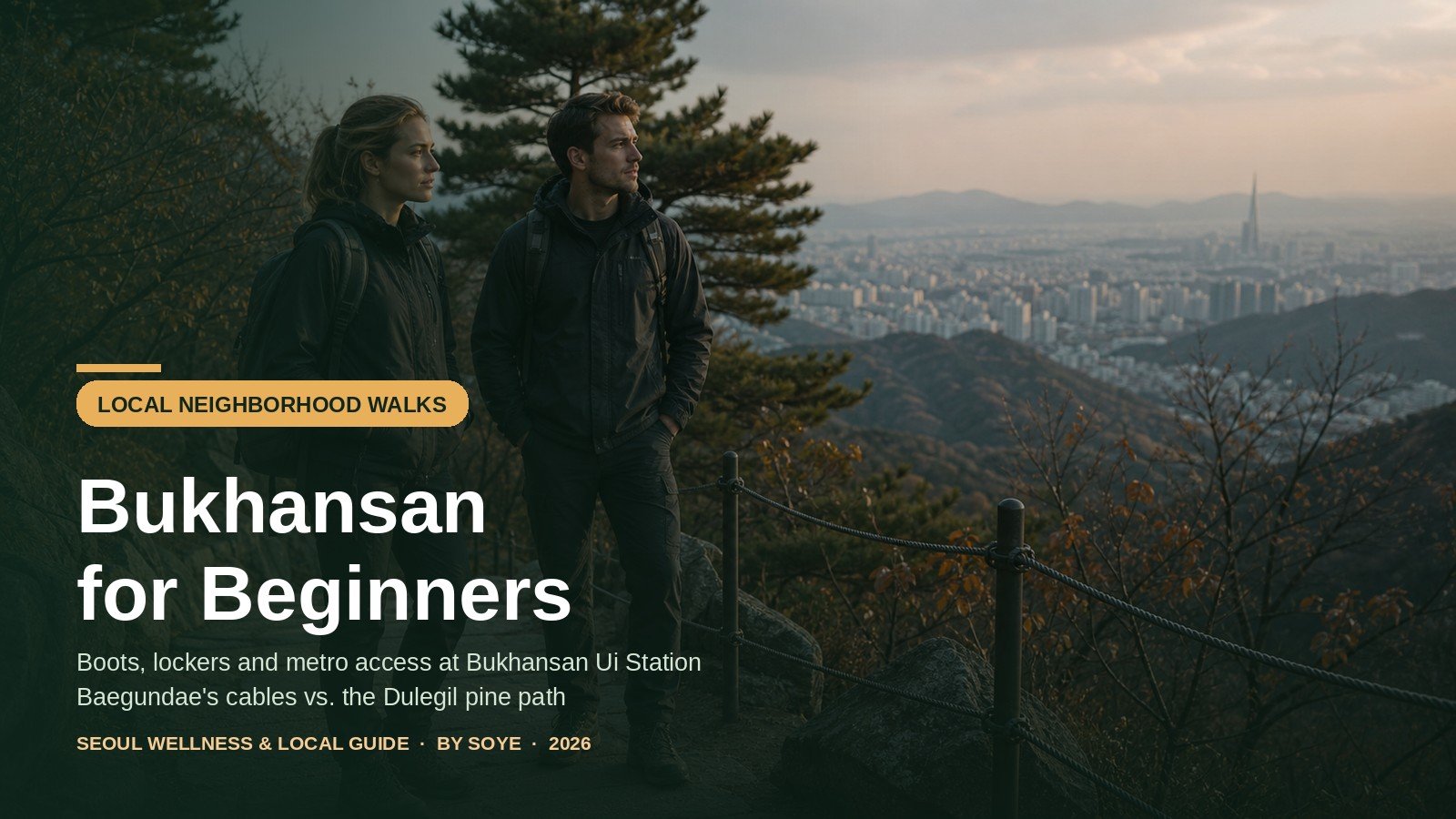
Bukhansan ends where the city pavement does. Step off the Ui-Sinseol line at its last stop and the road ahead runs past kimbap shops, a temple gate and a wall of grey granite that looks nothing like the skyline. On a weekend, a good share of the people on the 836.5 m summit are visitors who landed in Seoul with a suitcase and trainers — and rented their boots at a city office five minutes from the station.
The practical version of that day: exit 2 to the summit and back, what the rental centre hands over and what it costs, how the routes compare, the daylight limits November imposes, and the rules that come with fines.
Quick Verdict
Rent boots and a jacket at the Seoul Hiking Tourism Center beside Bukhansan Ui Station, then choose: Trail C to Baegundae for the summit and the steel cables, or the 3.1 km Dulegil pine path if you would rather not. Walk by 09:30 and be down by 16:30 — that is when the gear goes back.
What you are walking up
Bukhansan National Park covers 79.92 km² of northern Seoul and southern Gyeonggi Province and takes around five million visits a year — the most visitors per square kilometre of any national park on earth. Three granite domes give the older name Samgaksan: Baegundae at 836.5 m, Insubong (810.5 m), the country’s best-known climbing crag, and Mangyeongdae (799.5 m).
None of it needs technical climbing. The ground is stone nearly all the way up, built as staircases rather than switchbacks, so the effort lands on your knees coming down. Grip matters more than fitness — which is why the rental centre exists.
Getting there: the Ui-Sinseol line, exit 2
Bukhansan Ui is the last stop of the Ui-Sinseol light rail, twelve stops north of Sinseol-dong, where lines 1 and 2 meet — 35 to 45 minutes from Myeongdong. The ride costs ₩1,550 with T-money or a Climate Card, transfers within 10 km are free, and our transit card comparison settles which card to buy. The last train back leaves at 00:37 on weekdays but 23:37 at weekends — an hour earlier exactly when the mountain is busiest.
Out of exit 2, the rental centre is 300 m and five minutes on foot. Buy water here: the street has convenience stores and kimbap shops that open early for hikers. There are no lockers in the station, so the centre’s are the only ones at this end of the mountain.
Most guides skip the gap between station and trailhead. The Baegun Visitor Center sits at Doseon Plaza, 2.0 km up an asphalt road, 30 minutes on foot. A taxi from the stand by exit 2 charges roughly ₩2,000 per person uphill, ₩1,500 down, cash only — the best ₩2,000 you will spend here, because it saves an hour and a kilometre of knees.
The temple shuttle near that stand needs correcting first. It exists for visitors to Doseonsa temple, not hikers, and signs at the stop have restricted hiking parties; the fare is published nowhere official and people who have ridden it report about ₩1,000. Treat it as a bonus; plan the walk or taxi as the real route.
Renting gear at the Seoul Hiking Tourism Center
The centre is on the fifth floor of the Gwangnim Building, 52 Samyang-ro 173-gil, Gangbuk-gu, run by the Seoul Tourism Organization for travellers who want a mountain without a second suitcase. It opens 09:00–18:00, closed every Monday and on 1 January and the lunar holidays (17 February and 25 September in 2026). Staff work in Korean, English, Chinese and Japanese.
You can borrow a full outfit, not a token pair of shoes: boots, jacket, top and trousers, gloves, poles, daypack, and crampons in winter — Black Yak stock, steam-cleaned. Who can rent: foreign visitors, plus any Korean friend hiking with them, on production of a physical passport or ARC. A photo on a phone will not do, and a Korean arriving alone is refused.
What it costs: here the internet is confidently wrong. The official site publishes no price list — only the word “affordable” — and each booking button opens a Klook page with the live total. As a working figure, small items start near US$2 and boots or a jacket near US$6 each, putting a full set at ₩10,000–20,000; a Time Out writer who rented a bag, trousers, shoes and gloves here in April 2026 paid under S$12. The ₩1,100–2,200 figures still quoted on Korean city pages date from 2023 — history, not a price. A free walk-in promotion for foreign visitors ran until 15 November 2026 and has ended, so check the booking page for your date.
Book or walk in? Reserve at seoulhiking.or.kr, which hands off to Klook, or turn up and ask. Walk-ins are normal on a quiet weekday; at weekends the common boot sizes are gone by mid-morning.
The 16:30 rule decides your whole day: the centre closes at 18:00, but hired gear is due back by 16:30, and a Baegundae round trip is four to five hours before you add the 30-minute walk down to the plaza. Ask for the extension number when you collect it.
Downstairs there is a shower (bring a towel), and lockers hold a daypack or carry-on, not a full-size suitcase.
| Item | Available | Rough price | Notes |
|---|---|---|---|
| Hiking boots | Men’s and women’s sizes | ≈ US$6 / item | Grip is the point; bring thick socks |
| Jacket | Windproof shells | ≈ US$6 / item | Worth it November–March |
| Top and trousers | Sized | ≈ US$2–3 / item | Changing rooms on the same floor |
| Gloves, poles, daypack | Yes | ≈ US$2 / item | Gloves are not optional on the cables |
| Crampons | Winter only | ≈ US$2–3 | Ask; do not assume they are in the pile |
| Lockers | Free and paid, foreigners only | ₩2,000 mid / ₩4,000 large | Daypack or carry-on, no big suitcase |
| Shower, changing room | Yes | Free | Bring your own towel |
| Rental return | Same day | — | By 16:30, not by closing |
Which route: Baegundae, Yeongbong, the valley or the Dulegil
The centre’s English guide splits the day into three trails from its front door, which is more honest than park tables that start at the trailhead. Trail C to Baegundae is 4.1 km and about 130 minutes one way, advanced. Trail B to Yeongbong (604 m) is 4.3 km and 110 minutes, intermediate — a real summit and a hard final pull, but no cables. Trail A follows the Sogwicheon valley for 3.5 km and 100 minutes at beginner level, with no summit.
Separately, the Bukhansan Dulegil is a 71.5 km circuit of twenty-one low paths around the mountain’s skirts, and its first section is the best easy walk in northern Seoul. Section 1, the pine forest path, starts at the Ui-ryeong-gil entrance two minutes from exit 2 and runs 3.1 km, about 90 minutes, to Solbat Park — eight minutes from Solbat Park Station, one stop back down the line. Easy graded and no gear needed.
The Bogungmun route from Jeongneung is the third way up if you want a fortress gate without a summit: 2.4 km, 80 minutes one way, graded “easy” — one of only three routes in the park that low — to the gate at 567 m. Reach the trailhead on bus 110B or 143 from Gireum Station to the terminus, or 1.2 km on foot from Bukhansan Bogungmun Station. The Cheongsu Falls stretch is closed through 2026, and the only toilet is at Cheongsu, halfway.
| Route | Distance / time | High point | Difficulty | Footwear | Choose it if… |
|---|---|---|---|---|---|
| Baegundae Trail C via Doseonsa |
4.1 km / 130 min one way | 836.5 m | Advanced: stone stairs, 300 m of cables | Boots with grip, gloves | You came for the summit |
| Yeongbong Trail B |
4.3 km / 110 min one way | 604 m | Intermediate: steep, one short railed rock | Boots or grippy trainers | You want a summit without the chains |
| Dulegil section 1 Pine forest path |
3.1 km / 90 min, point to point | 183 m of climbing | Easy: wide, soft, no stairs | Anything | You want a forest walk, not a climb |
| Bogungmun from Jeongneung |
2.4 km / 80 min one way | 567 m gate | Easy: 440 m ascent, stone underfoot | Boots or grippy trainers | You want fortress walls and quiet |
Five steps from station to summit
- Ride to the end of the line, leave by exit 2. ₩1,550 each way. Buy a litre of water and a snack on the walk to the centre; there is no reliable refill above the visitor centre.
- Collect gear at 09:00, walk by 09:30. Passport on the counter, boots fitted over the socks you will hike in, gloves and poles taken, city clothes into a locker. Ask for the English map and the extension number.
- Take the road to Doseon Plaza. Two kilometres, 30 minutes, or ₩2,000 in a shared taxi. Use the toilet here — the last flush one before the mountain.
- Climb Haroojae, rest at the shelter, take the gate. From the visitor centre: 0.8 km to Haroojae, 0.6 km to Baegun shelter past the Insubong cliffs, then 0.5 km to the summit. Rest properly — the last stretch is the steepest thing here.
- Turn around by 13:30, hand the gear back by 16:30. Descent is faster but harder on the knees, and the valley goes dark early. Then a shower and tofu 300 m away.
The last 300 metres
Every route funnels through Baegunbongammun, the gate just below the top, and the final 300 m above it is the same: bare granite slabs, steel cables bolted into the rock, and a path too narrow for two people to pass without one stopping. The park service allows 20 minutes for the 0.5 km from the shelter; on a busy Saturday, half an hour of standing is normal, because the queue up and the queue down share one cable.
This is where city trainers become a real problem. Polished granite with a film of dust or morning damp has almost no friction under a flat rubber sole, and the cables are there because people fall. Two cheap fixes: rent the boots, and put rubber-coated work gloves on — convenience stores sell them for about ₩1,000, and the centre lends gloves too.
Cable etiquette is unwritten but firm: up has right of way on narrow sections, nobody stops mid-run to photograph, and a faster party behind you gets the widened slab. The summit stone has a 20-to-30-minute queue; the view is identical ten metres behind it. There is no toilet and no water at the top — the last facilities are Doseon Plaza and the block above Insu shelter — and everything you carry up comes down, tissues included.
Light, ice and the 17:20 sunset
November catches people out, because the mountain stays open while the day closes. Seoul’s sunset runs 17:22 on 15 November and 17:15 by 30 November, and a valley floor loses usable light 20 to 30 minutes before that. Bukhansan’s entry cutoffs are 17:00 from March to November and 16:00 from December to February — the deadline for starting up a trail, not for being off the mountain.
The working plan for a late-autumn day: on the trail by 09:30, summit by 13:00, back at Doseon Plaza by 15:30, gear returned by 16:30. Anyone starting after 13:00 in November is planning a descent in the dark, cables included.
From December, ice changes the equation. The park service asks hikers to wear crampons on upper trails in winter, and the stretch from shelter to gate is why: it faces away from the sun and holds ice for days. Rent them with the boots. After rain and a hard freeze, take Trail B to Yeongbong instead.
Rules that carry a price
Korean national parks enforce their rules with fines. Smoking outside a designated area is ₩600,000 on a first offence and up to ₩2,000,000 after that. Camping outside a site runs ₩200,000–500,000; cooking, littering and drinking at shelters, designated trails or summits — Bukhansan’s Daedongmun, Daenammun and Samobawi among them — are ₩100,000; entering a closed area starts at ₩200,000. In practice: no beer at the top, no cigarette anywhere, no camping stove, no shortcut onto a side path.
The rule that surprises visitors most has no bin attached. There are effectively no rubbish bins on the trails — the park’s policy is that walkers carry out what they carried in — so a banana skin, a coffee cup and a ramyeon container all go back down in your bag. On the Dulegil it matters more, because the path passes through residential lanes.
Two seasonal facts belong in your planning. Korea’s autumn fire-watch period runs 1 November to 15 December 2026. For Bukhansan the 2026 list closes only Darakwon entrance to Eunseokam (1 km, Dobong side), and Baegundae stays open. Separately, the Academy Park–Gucheon valley–Daedongmun route has been shut since a landslide in August 2025. Check the closure page the week you go; the mountain closes entirely under typhoon or heavy-rain warnings.
- Physical passport in the bag — the rental counter cannot take a photo or a copy.
- Boots with real grip, rented or your own, plus thick socks; trainers only for Trail A or the Dulegil.
- Gloves — ₩1,000 work gloves or the rented pair, for the cables.
- 1 litre of water and a snack from the station; no refill above the visitor centre.
- A 16:30 return in the plan and a 13:00 summit deadline, with a headlamp in the bag.
- No smoking, alcohol, stove or litter — ₩100,000 to ₩2,000,000 depending on the rule.
After the descent: Ui-dong
Ui-dong’s food street exists because of the mountain, and the menu is built for legs that have just done 900 m of climbing. The local sequence is sundubu first, pajeon and makgeolli if the day went well, and the restaurants sit minutes from the station.
The reference point is Ouricong Sundubu at 46 Samyang-ro 173-gil, hand-made tofu on this corner since 1996: sundubu ₩11,000, cheonggukjang ₩11,000, dotorimuk ₩20,000, mung-bean jeon ₩15,000–18,000, tofu hotpot on anchovy and shrimp stock. They make the day’s tofu in the morning and close when it sells out, sometimes by 18:00. For seafood, Park Seung-gwang Haemul Son Kalguksu at 17-1 Ui-dong serves hand-cut noodles with squid, abalone and shrimp for ₩15,000 (two servings minimum), and a haemul pajeon at ₩18,000; English menu, closed Mondays. San Dubujip at 61 Samyang-ro 173-gil runs 09:30–19:30 with no English menu — point and smile.
Makgeolli with a seafood pancake after a hike is not a tourist ritual; it is what Seoul people do on a Sunday. Order one bottle between two, and note the weekend last train leaves at 23:37. If your legs want running tomorrow, the sister site’s Namsan north ring loop is the city-centre equivalent, and our night running routes are the flat version.
FAQ for first-timers
Can I hike Bukhansan without hiking boots?
On Trail A and the Dulegil, yes — trainers are fine. On the Baegundae cables, no. The last 300 m are polished granite slabs where a flat city sole has almost no grip. Rent boots for a few thousand won rather than risk the one section where footwear decides whether you fall.
Do I have to book the gear, or can I just turn up?
Both work. Walk-ins are normal on weekday mornings; weekends run out of common sizes by mid-morning, so book two or three days ahead at seoulhiking.or.kr. Either way gear goes back by 16:30, before the 18:00 closing — ask for the extension number when you collect it.
Will my suitcase fit in the lockers?
A daypack or carry-on, yes; a full-size checked suitcase, no. There are no lockers at Bukhansan Ui Station either, so leave big luggage at the hotel. The centre also has changing rooms and a basement shower — bring a towel.
What happens if I come on a Monday?
The Bukhansan centre is closed every Monday; the mountain is open as usual. Alternatives are the Bugaksan centre in Samcheong-dong (closed Tuesdays) and the Gwanaksan centre (closed Wednesdays), or hike in what you have on Trail A or the Dulegil. Monday is also the quietest day on the trails.
Is there a toilet at the summit?
No. The last toilets are at Doseon Plaza and the small block above Insu shelter on the climb. There is no water either, so carry a litre up and everything back down, tissues included.
Do trails close when it rains or snows?
Rain alone does not close the mountain, but heavy-rain, typhoon and landslide warnings close it entirely. From 15 November to 15 December 2026 the fire-watch period closes only Darakwon–Eunseokam on the Dobong side; Baegundae stays open. Check the closure page the week you go, and take crampons after snow and a freeze.
Can hikers take the Doseonsa shuttle bus?
The shuttle is provided for temple visitors, signs at the stand have restricted hiking parties, and the fare is not published — people who have ridden it report about ₩1,000. Walk the 2 km road in 30 minutes, or take a shared taxi at roughly ₩2,000 per person, cash only.
Cheat sheet
Final Summary
- Transport: Ui-Sinseol line to Bukhansan Ui, exit 2, ₩1,550 with a transit card. Last train back is 00:37 on weekdays, 23:37 at weekends.
- Gear: Seoul Hiking Tourism Center, 5F, five minutes from exit 2 — boots, jacket, trousers, gloves, poles, crampons, ₩10,000–20,000. Closed Mondays, passport required, back by 16:30.
- Routes: Baegundae 4.1 km / 130 min one way, advanced; Yeongbong 4.3 km / 110 min; Sogwicheon valley 3.5 km / 100 min; Dulegil section 1 pine path 3.1 km / 90 min, no gear needed.
- Timing: walking by 09:30, summit by 13:00, down by 16:00. Sunset 17:15–17:22 in late November and the valley darkens first; entry cutoffs 17:00 (Mar–Nov) and 16:00 (Dec–Feb).
- Rules: no smoking (₩600,000), no drinking at shelters or summits (₩100,000), no cooking or litter (₩100,000), no bins — carry it out.
Last checked: 17 November 2026, against the Seoul Hiking Tourism Center’s English guides and booking pages, Visit Seoul’s centre listing, the Korea National Park Service Baegundae and Bogungmun course pages and 2026 closure notice, the entry-hour table, Korea’s Natural Parks Act fine schedule, Ui-Sinseol timetables, Seoul’s fares and mid-November 2026 Ui-dong prices. Hours, tariffs and closures change — confirm before you travel.